We didn't take many pictures yesterday, but there were 3 in the post.
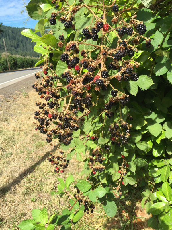
Blackberries!
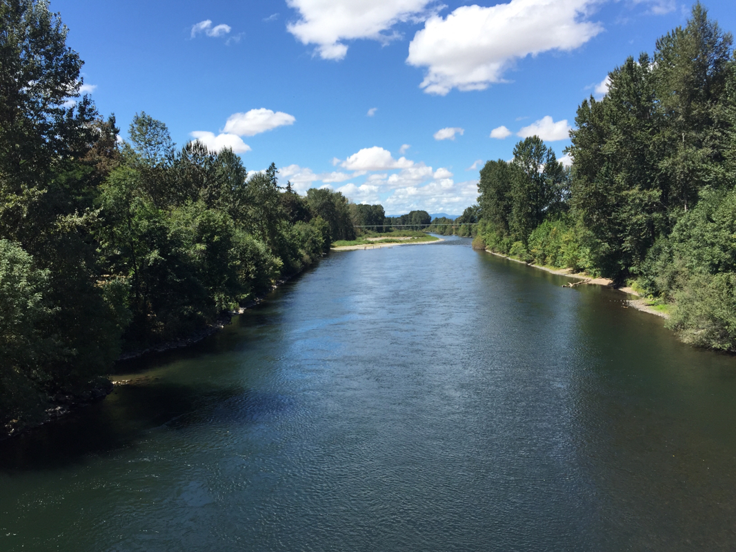
The MacKenzie
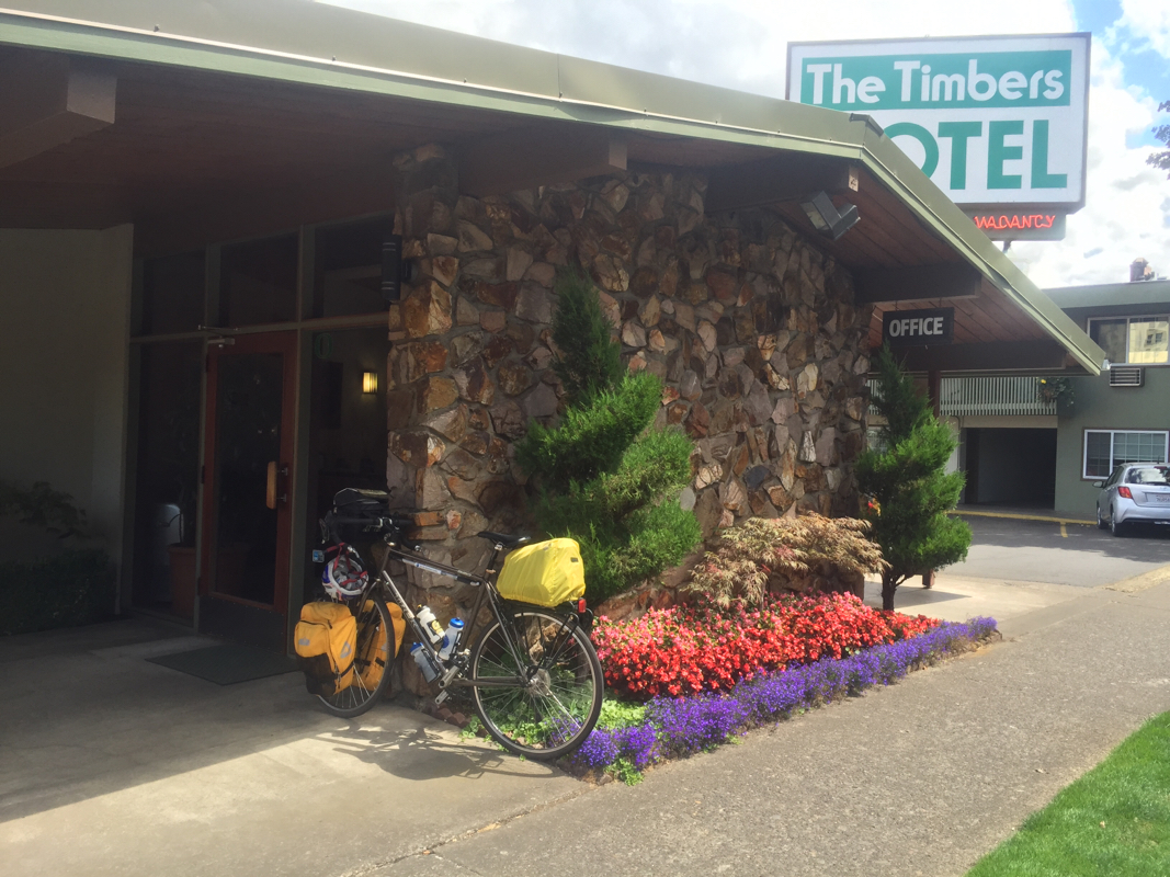
Our hotel.
|
We didn't take many pictures yesterday, but there were 3 in the post. Blackberries! The MacKenzie Our hotel.
2 Comments
We woke to the smell of diesel exhaust in our room. We never did figure out why, but we hustled over to Takoda's for the Rainbow breakfast--2 eggs and 3 pancakes. We hit the road around 9 with about 50 miles to go. Route 126 was busier than expected. Usually there was a good shoulder, and the traffic was polite, but the truck tire noise was wearing. We were running along the MacKenzie for a good portion of the day. There was a lot of shade and the road was rolling, but primarily downhill. The berms were covered blackberry bushes bearing loads of ripe fruit. Finally, we yielded to temptation. Yummy! We also kept seeing lots of orchards but we didn't recognize the trees, which were full of leaves but had no visible fruit. When we got to Walterville, we circlred looking for a shady spot to eat. A man came out of his house and suggested we rest in his very shady front yard. It was heavenly. It was also near a market where we were able to obtain a double chocolate Magnum bar (Marie) and a Good Humor bar (Roy). Thus fueled, we opted to follow the ACA route, which was 6 miles longer than staying on Route 126. We saw lots of cyclists on this route. One told us we were on a great route, but to be sure to always lock our bikes in Eugene. The route was pleasantly rolling, but the traffic was much calmer. We climbed up a road called MacKenzie View, and it delivered. Entering Eugene, the population sign said 157,100, approximately 1000 times larger than some of the towns we have been in recently. Biggest place we've been in since St. Paul. As we did our usual make two wrong turns then consult the map again thing, a cyclist came up and asked if he could help us. He explained we were being routed on a side street because there was less traffic. He also told us this was an unusually prolific year for blackberries and that the orchards in question were filberts or hazelnuts. He said Oregon is one of the largest producers of these nuts. No wonder we couldn't see any fruit! Oregonians are smart and informative! We are staying at the Timbers Motel, which is very centrally located. Speaking of Oregonians who are smart and informative, we are looking forward to having dinner with two former Washingtonians who are now Oregonians, Ginny and Dave. Tomorrow we will have a day to tour Eugene with Dave and Ginny. We will also rest, plan, and refit for our next leg of the trip. The plan is to be in Florence, Oregon (the coast!) on Tuesday and then check out the Pacific Coast Highway. Today was perfection--weather, road surface, polite traffic, amazing scenery, and Roy found a home for the pump. The planets aligned for us. 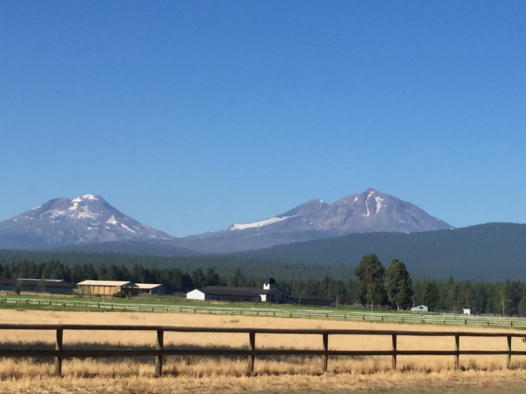 Leaving Sisters we had a great view of the Sisters Mountains. The road was level, shady, and had little traffic. When the climb started, we were in our very bottom gear, but somehow, it never seemed that difficult. Although we had read that we would pass a lava flow, when we actually came to where we could see that the road ran right through a lava field, we were amazed by its extent. 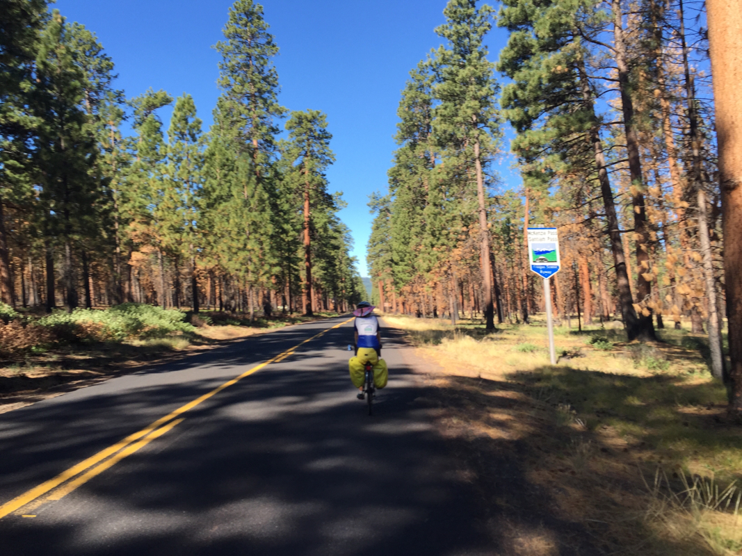 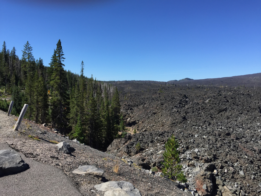 The road twisted through the volcanic rocks that in places towered over our heads. 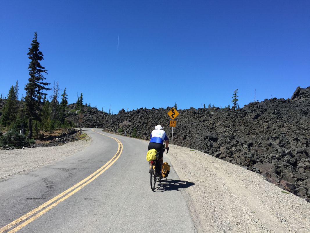 When we got to the top, two hikers of the Pacific Crest Trail took our picture. They started in Canada in July and expect to finish in Mexico in November. 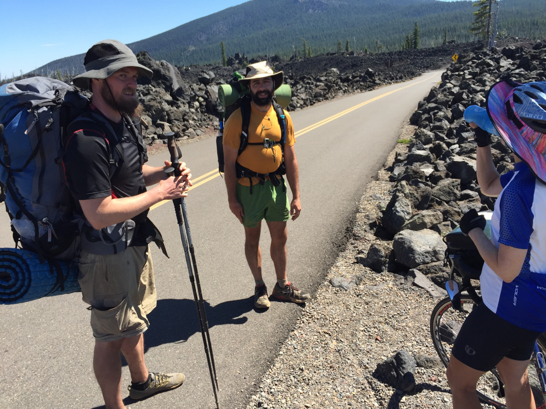 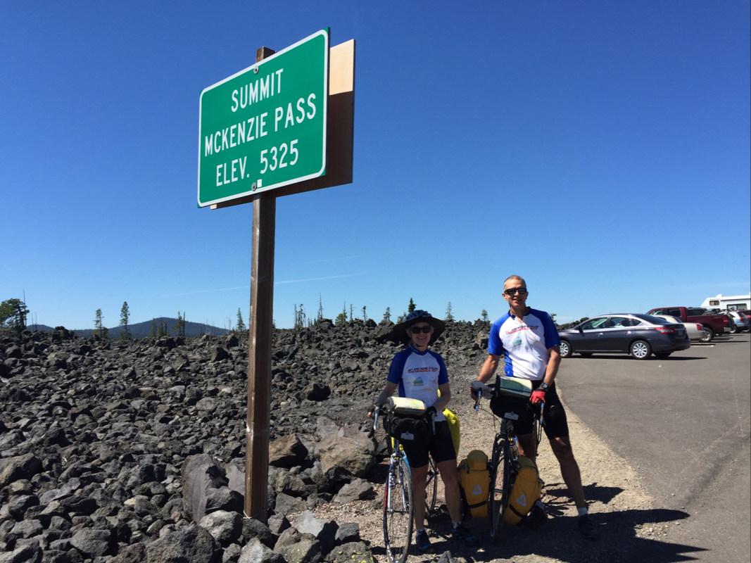 We enjoyed the scene at the top, everyone enjoying the beautiful Sayurday. Climbing up to the Dee Wright Observatory revealed an excellent view of many peaks. 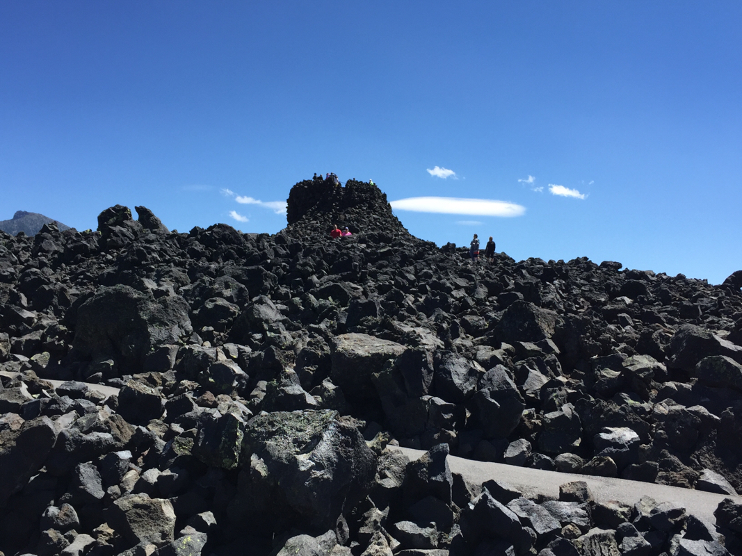 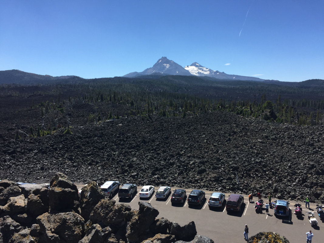 It was 15 miles to the top and then about 25 shady miles downhill. Traffic was light and quite patient, waiting until we waived them to pass us. Soon we came to MacKenze Bridge, where we thought we were staying. Actually, our motel is 3 miles further down the road in Rainbow. Right next to our motel is a newly opened Nike shop, Blazing Saddles Cyclery. Roy rode over to check it out. He deemed it a worthy home for the pump, and Avery, the store manager, was happy to accept it. 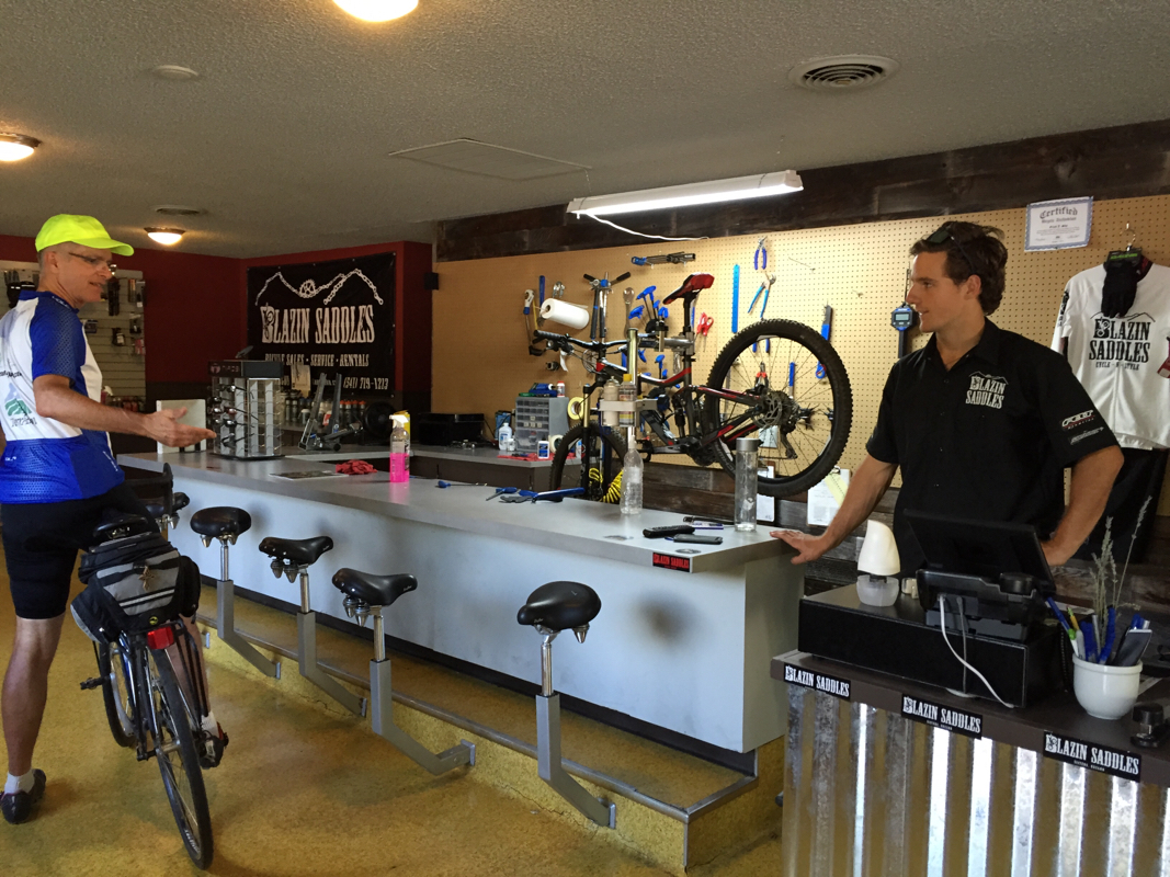 Except for the fact that the wifi is sketchy, Rainbow meets our basic needs: motel, bike shop, grocery store, and restaurant. Besides a gas station, there doesn't seem to be much else within walking distance. The restaurant was packed by 5:30. Tomorrow we ride to Eugene. It should be around 50 flat miles. We are hoping the traffic will be light on Sunday morning. Today was an easy 40 mile stretch to Sisters. It was no fun because we were on a shoulder while trucks roared by us. We both contemplated: which was worse? The North Dakota interstate, or this? Tough question. Sure felt safer on the interstate. I guess we have gotten spoiled by the scenic roads. Today being Friday, I think we had all the business traffic plus hordes of huge camper-trailers. 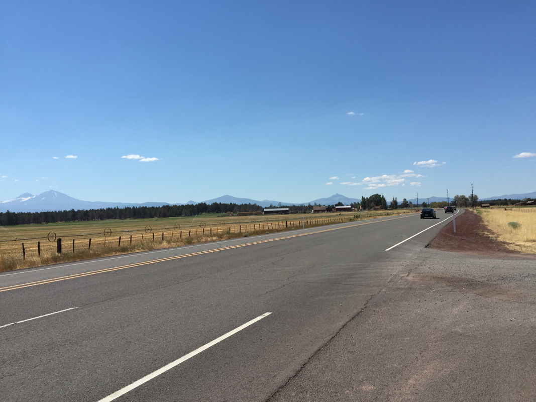 The 3 sisters mountains loomed in the distance but frankly our eyes were on the narrow shoulder. 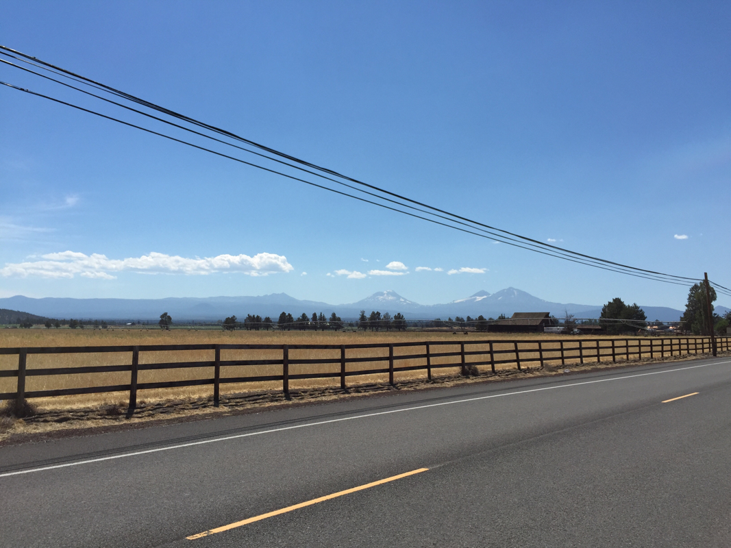 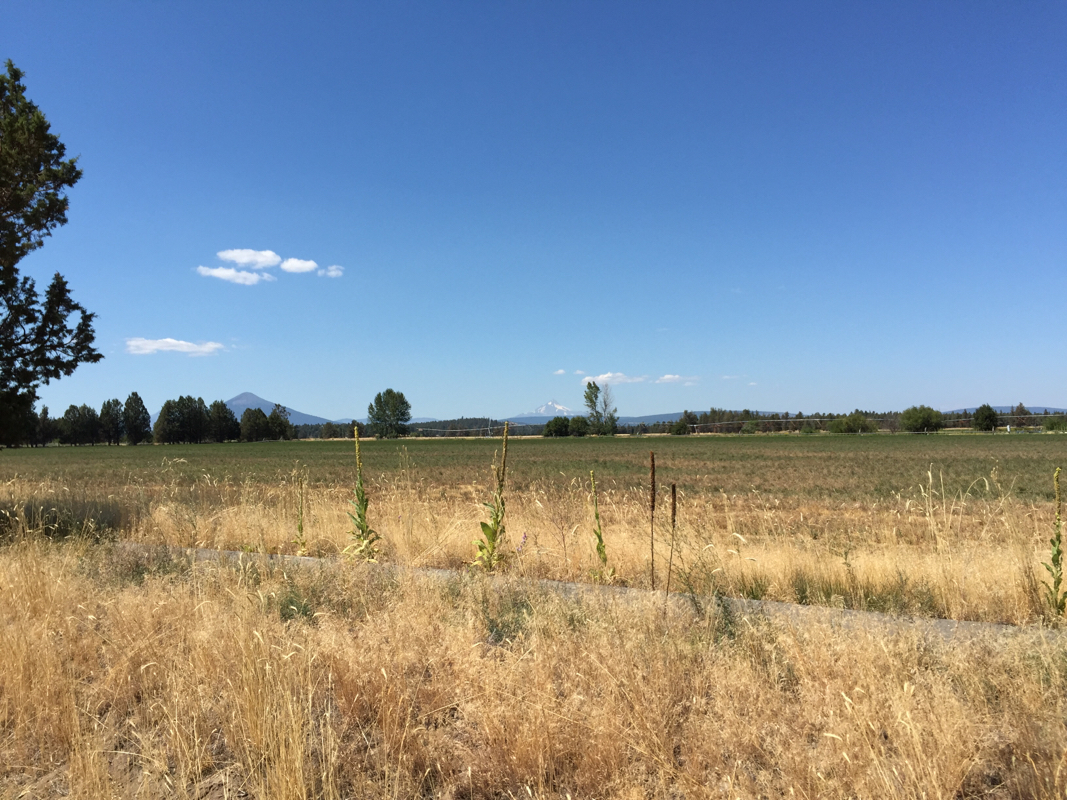 Sisters is a vibrant tourist town, packed for the weekend. There is a lot going on here. We're staying at the Ponderosa Lodge Best Western, and they have llamas on the property, just for fun. The view from our balcony: 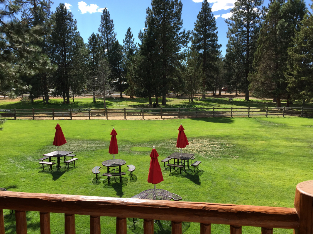 We had dinner at a wine bar/art gallery named Open Door. Arugula lettuce, goat cheese, beet salad, at last! Washed down with an Oregon Pinot Noir that was very substantial. No salt & pepper shakers on the table and no ice in the water. Yes! Points off for asking us to keep our fork instead of giving us clean silverware, but otherwise, it sure was nice to be in a place this nice. 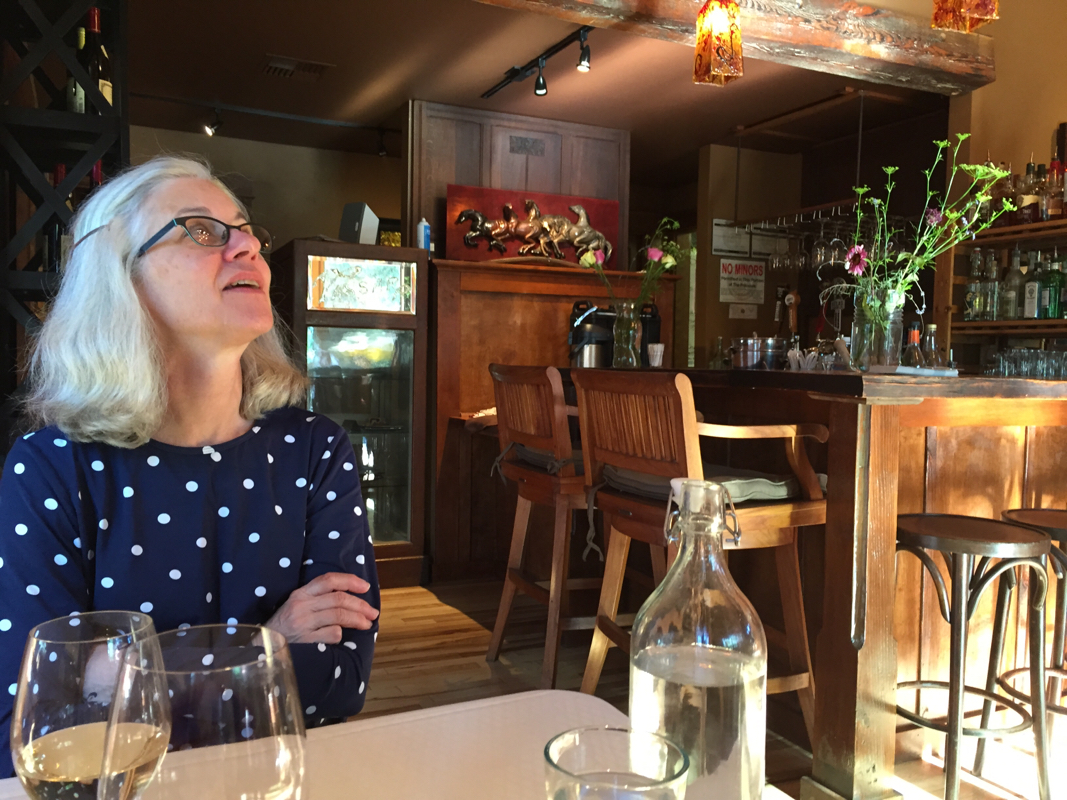 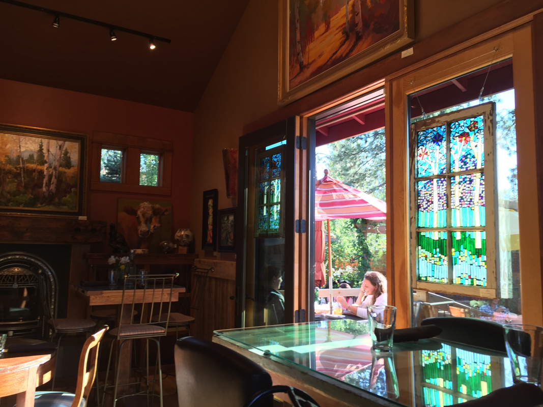 We have to laugh about our tan hands. You can see the glove marks. 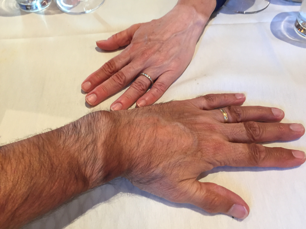 I use suntan lotion but not in the gap between my watch and the glove, and not on the ends of my fingers. Tomorrow we will spend the first 15 miles climbing the highest, and the last, pass in the Cascades, rising 2,000 feet from our current altitude. McKenzie Pass is 5,235 feet high. According to our route profile map, it will be all downhill from there, all 150 miles to the ocean. We are only doing 45 miles tomorrow but I'm sure it will be a full day. 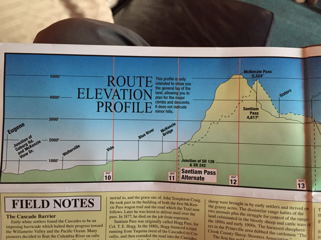 Today's post should be subtitled "Roy Rides to the Rescue" On this trip Roy has been obsessive about not carrying anything he deems unnecessary. He throws out paper receipts, discards maps of places we won't be coming back to, and refuses plastic bags when we buy groceries. So I was a bit surprised this morning when he said he had just seen a bicycle pump on the side of the road and was going to go back to get it. 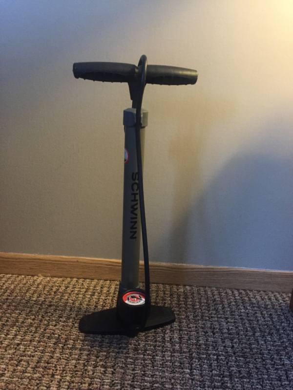 A few seconds later he returns with a new-looking Schwinn bicycle pump. "What are you going to do with that? How are you going to carry it?" I asked. He didn't know, but maybe he'd leave it at this cool bike shop in Prineville that we had heard about last night. As for carrying it, why that was what his drop down panniers on his rear rack bag were for. 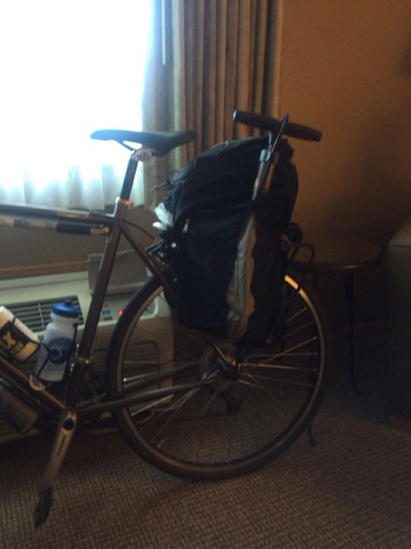 So we set off. After a bit he decides he should inflate our tires just to make sure the pump worked. Although he had to use an adapter because it had a Shrader (car tire) valve, it worked fine. The first 5 miles or so were downhill. We were on a scenic byway with a cool name. 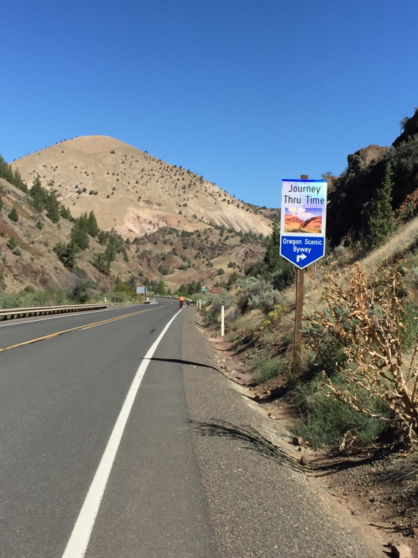 Although we stayed on Route 26 all day, the Journey Through Time headed off toward the John Day Fossil Beds National Monument. Soon we were headed up an 11.5 mile long hill. Even the road cuts were interesting. 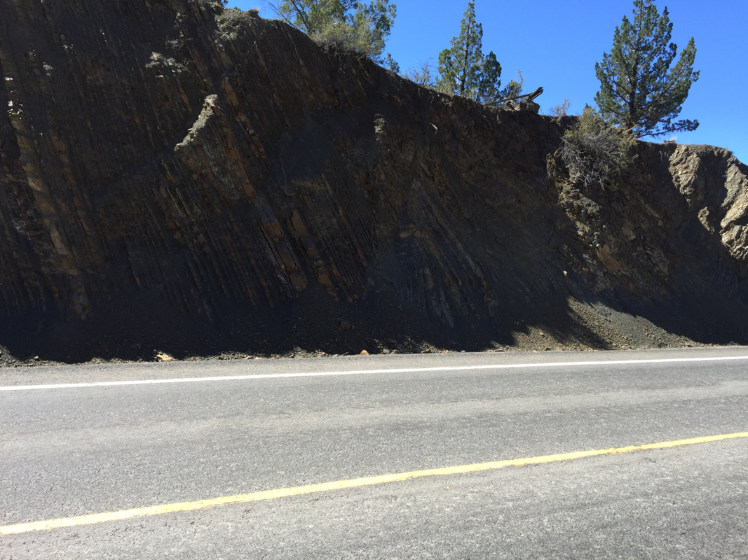 There were shady places to stop and rest. 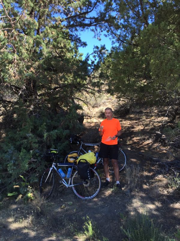 We passed by the site of a 21st century forest fire. 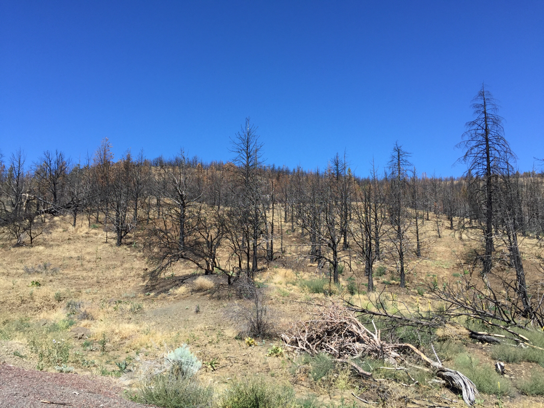 As I passed by a pull off, I noticed a motorist reading his drivers' manual. Since my mechanical skills are limited to reading owners' manuals to Roy, I did not stop to offer assistance. Several hundred feet later, I noticed a shady spot and thought "I better stop here because when Roy passes the motorist, he will probably stop and help." Sure enough he did. I couldn't hear what was said, but I heard Roy laughing. 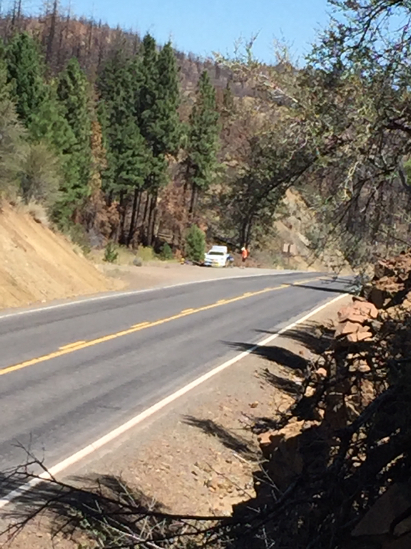 Sure enough. The motorist had a flat tire and his spare was not sufficiently inflated. Roy just happened to have a pump. When Roy rejoined me, he said the motorist asked if that was his wife up ahead and whether he had a means to communicate with me. Roy told the motorist he didn't need a means of communication because I always know what he is thinking. If only. Shortly thereafter, the motorist passed us and tooted his horn and waved his thanks. 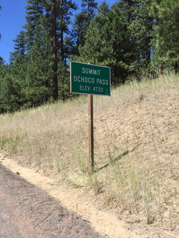 It took us three hours, counting stops, to get to the top of the pass. A mile later we came to a rest area with shade, picnic tables, and outhouses. The rest of the day was mostly down hill. 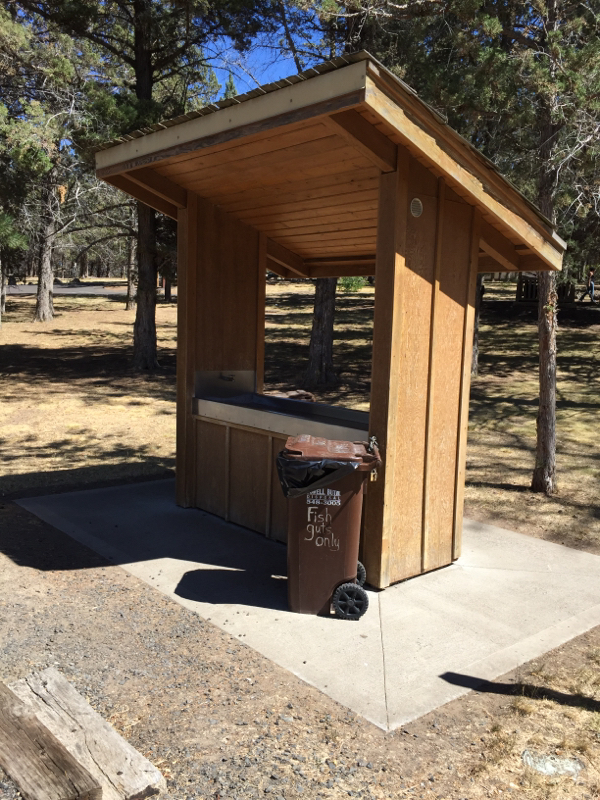 We stopped at a county park which seemed to have very specialized waste containers. We found containers for pet waste and recycling, but we carried our paper trash out since we didn't see any ordinary trash bins. Prineville has about 10,000 residents. We passed two grocery stores and a Starbucks coming into town, and we are staying on the western edge. We haven't even seen the town yet. The Best Western seems like a luxury resort after the historic Oregon Hotel with the bath down the hall. 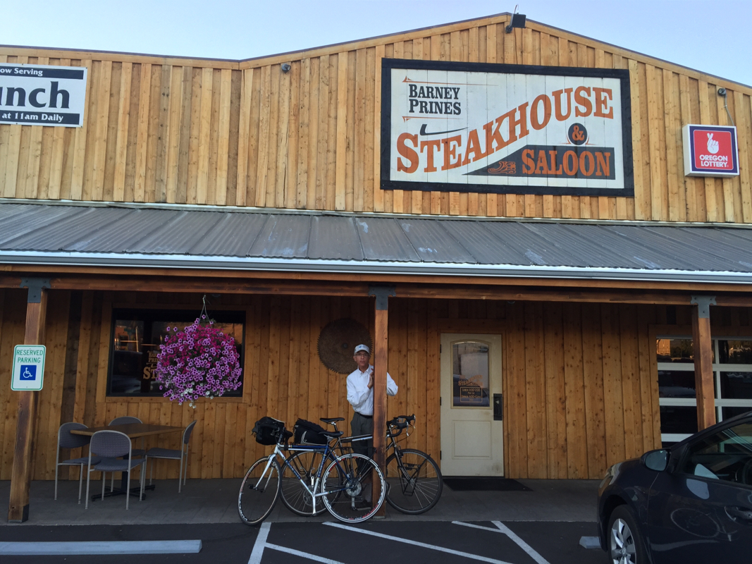 Barney Prine's Steakhouse was recommended to us by some eastbound cyclists last night, and it was very good. |
AboutWe are spending this summer bicycling from Virginia to California. Archives
August 2015
Categories |
 RSS Feed
